Search
Items tagged with: Panoramio
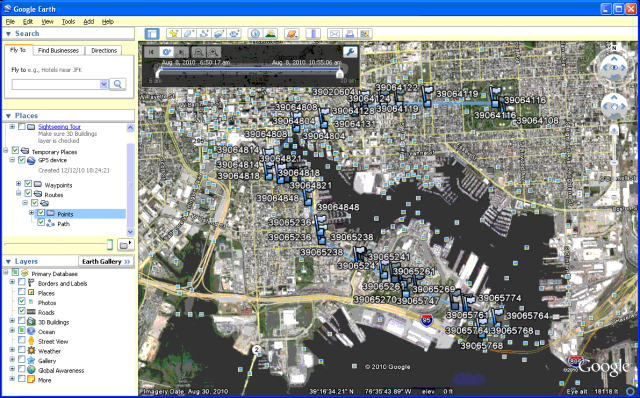
A Baltimore "Historic" #Trails map for the #FOSS4GNA conference, to orient nonresidents. Trail 1 goes from Patterson Park "ova east" straight into downtown, then hooks around to Fort Avenue heading for the national "shrine" of Fort McHenry. A 5-mile hike, one way, though you need to put thought into returning from whence you came (I did it by bus in 2010).
The numbers correspond to #Panoramio imagery, now reachable via thank you, archive.org.
e.g. Science Center in 2010:
https://web.archive.org/web/20161015173205/http://www.panoramio.com/photo/39064821
The numbers correspond to #Panoramio imagery, now reachable via thank you, archive.org.
e.g. Science Center in 2010:
https://web.archive.org/web/20161015173205/http://www.panoramio.com/photo/39064821
Panoramio - Photo of Maryland Science Center, Gwynns Falls Trail
Photo-sharing community. Discover the world through photos.web.archive.org

