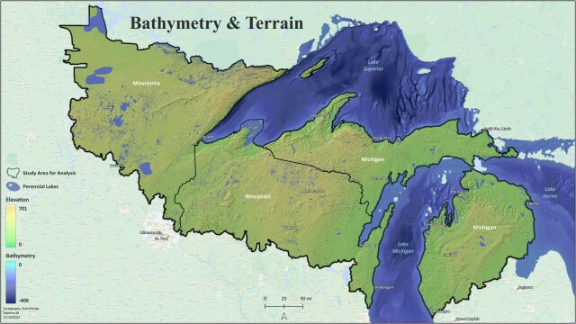
#30DayMapChallenge Day 10: North America A map of the bathymetry and terrain of the greater Lake Superior region. Lake Superior is the world's largest freshwater lake by area. This is part of a large analysis to compute omnidirectional biodiversity connectivity. More on that later 😊 #QGIS