Search
Items tagged with: 30DayMapChallenge
Élections présidentielles (tour 1) 2022, FR. Chloroplèthe à 4 composantes CMYK, 4 orientations politiques.
De belles répartitions apparaissent : des contrastées, des concentriques, des bariolées, et de bien sombres (sans parti pris !). Les géographes doivent se faire plaisir avec de telles données.
Une expression #qgis sur https://github.com/xcaeag/30DayMapChallenge-2023#jour-13--choropleth
. Patchwork.")
")
GitHub - xcaeag/30DayMapChallenge-2023: 30 days, 30 maps
30 days, 30 maps. Contribute to xcaeag/30DayMapChallenge-2023 development by creating an account on GitHub.GitHub

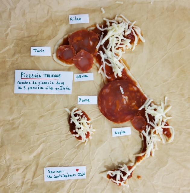
J'ai tenté quelque chose, j'espère que c'est suffisamment reconnaissable😃
Délicieusement réalisé avec plein d'ingrédients
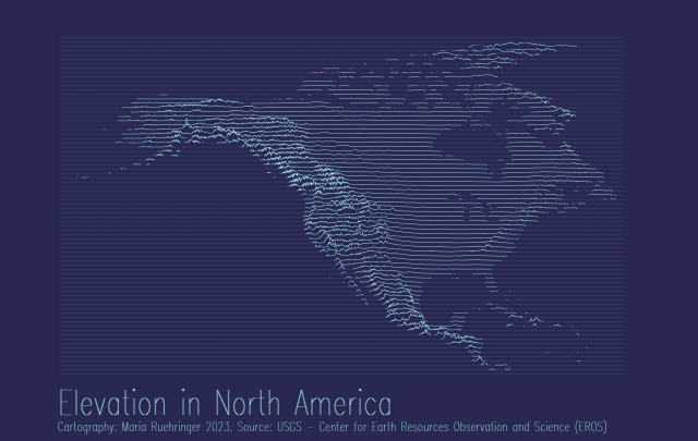
My first ever attempt to create an elevation joy plot 😁🗻
Tool: #QGIS
Data: USGS
#gischat
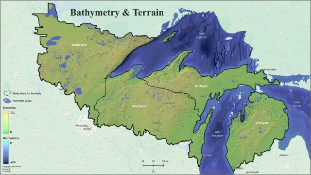
A map of the bathymetry and terrain of the greater Lake Superior region. Lake Superior is the world's largest freshwater lake by area. This is part of a large analysis to compute omnidirectional biodiversity connectivity. More on that later 😊 #QGIS
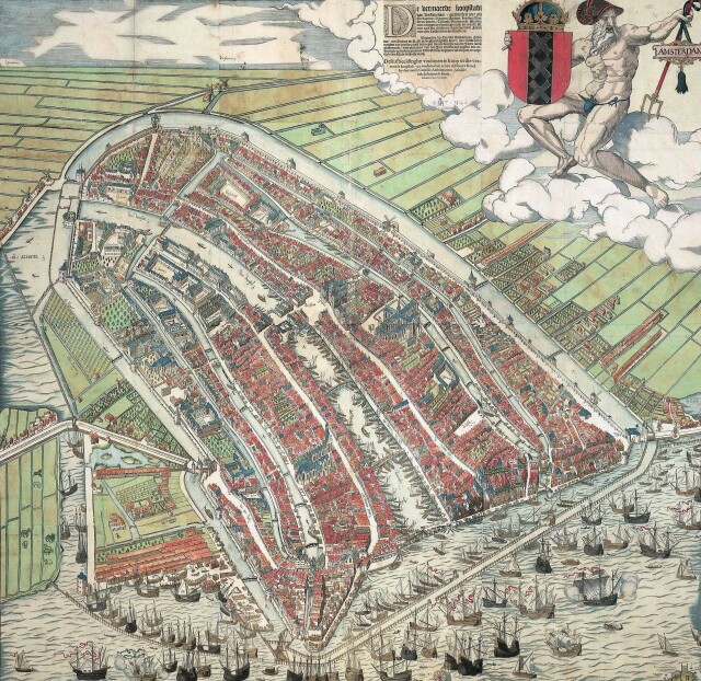
Full resolution image at the Rijksmuseum: http://hdl.handle.net/10934/RM0001.COLLECT.338646
Used #qgis. Does anyone know an accurate way to mark intermediate measurements on a continuous legend in QGIS 3.34?

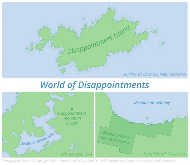
So much disappointment in just one map 😄🗺️
Tools: QGIS, Inkscape
Data: LINZ Data Service, OSM, Minnesota Department of Natural Resources.
#gischat
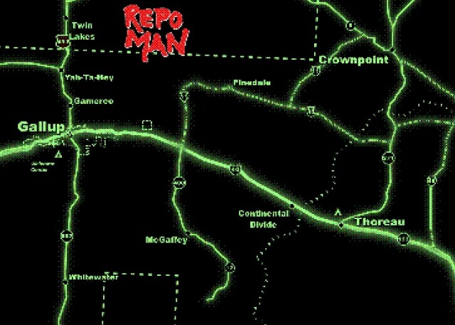
A slightly tweaked version of last years Repo Man (1984) map, but this time with the "Retro" #QGIS Easter egg deployed.
It is a recreation of the opening titles to one of my favorite movies and a place I used to live!
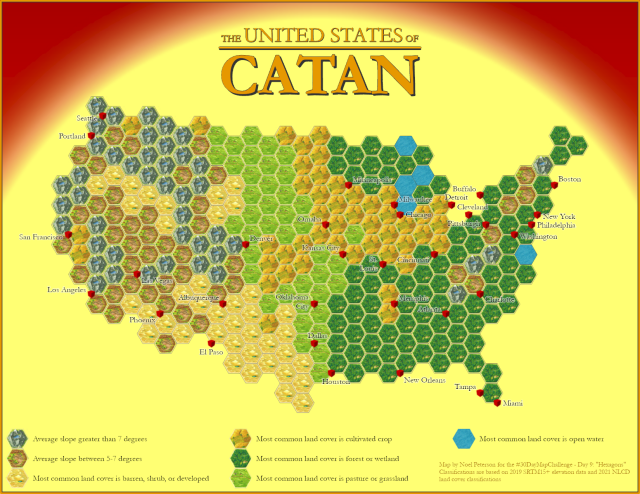
Ok, this one was a lot of fun. I used elevation and land cover data to categorize hex bins covering the contiguous United States, approximating the various tiles used in the board game Settlers of Catan. The tile icons were created by scanning the cardboard pieces. I also decided to represent a selection of major cities as "settlements" with 3D symbols that look (kind of) like the wooden blocks in the game.
#cartography