Search
Items tagged with: digitalhumanities
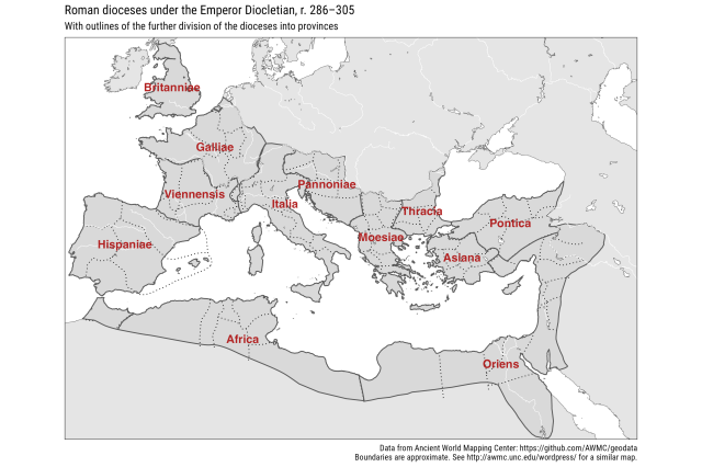
Day 3 #30dayMapChallenge polygons: Roman dioceses under the Emperor Diocletian, r. 286–305, with dioceses divided into further provinces. The boundaries of these are almost all approximate. The data comes from the Ancient World Mapping Center as it did for my day 2 maps. The diocese labels are based on centroids of the polygons and may be a bit difficult to read. Oh well.
Data: https://github.com/AWMC/geodata
Code: https://github.com/jessesadler/30daymapchallenge/blob/main/3-polygons.R
#rspatial #DigitalHumanities #DigitalHistory
Data: https://github.com/AWMC/geodata
Code: https://github.com/jessesadler/30daymapchallenge/blob/main/3-polygons.R
#rspatial #DigitalHumanities #DigitalHistory
GitHub - AWMC/geodata: The geodata collection of the Ancient World Mapping Center in GeoJSON format.
The geodata collection of the Ancient World Mapping Center in GeoJSON format. - GitHub - AWMC/geodata: The geodata collection of the Ancient World Mapping Center in GeoJSON format.GitHub

