Search
Items tagged with: mapmaking
Hi #gischat let's got for a 2nd Daily #mapmaking with #QGIS
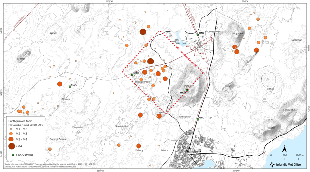
For the past 2 weeks or so we’ve had an ongoing earthquake swarm very close to the town of Grindavík in the Reykjanes Peninsula. The swarm is very likely caused by an inflating magma body currently at about 5 km depth. The shape of the body is most likely a flat sill expanding and causing earthquakes. These events might lead to an eruption very close to people’s homes and lots of infrastructure.
1/6
I thought it might be interesting for some of the #gischat members of Mastodon to share some of my everyday map making. A thread with a single map and some info on the data, techniques, tips, and tricks. Let's go!
Daily #mapmaking with #qgis
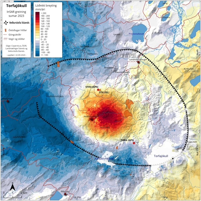
This map shows a recent #InSAR analysis for a volcanic caldera named Torfajökull. The InSAR signal shows there is surface inflation in the center of the volcanic caldera indicating sub-surface magma movement.
🧵 1/10
Daily #mapmaking with #qgis
This map shows a recent #InSAR analysis for a volcanic caldera named Torfajökull. The InSAR signal shows there is surface inflation in the center of the volcanic caldera indicating sub-surface magma movement.
🧵 1/10


