Search
Items tagged with: Openstreetmap
A small but significant way to help is updating Open Street Map, since it is used by emergency teams around the world; here’s links to emergency mapping going on in Alaska, Maui, and Vermont right now: https://lists.openstreetmap.org/pipermail/talk-us/2023-August/022052.html
#OpenStreetMap #OSM
The #OpenStreetMap Foundation spends, even with a slightly more ambitious budget this year than previously, less than %1 of what WMF/Wikipedia does, but is struggling to make ends meet.
There is no threat a la the infamous Wikipedia ads that the project will shut down, but without the funds activities will have to be cut back significantly.
If you consider OSM valuable consider https://supporting.openstreetmap.org/
Blog Post: https://blog.openstreetmap.org/2023/08/09/happy-birthday-openstreetmap-2/
Support here: https://supporting.openstreetmap.org/
#OpenStreetMap #OSM #gischat
📢 Calling all @openstreetmap users, developers, activists, GIS experts, communities, researchers, academics, cartographers, and curious minds to submit
🗣️ General talk (deadline - August 24, 2023): https://stateofthemap.eu/call-for-participation
🗣️ Academic talk (extended deadline - August 24, 2023): https://osmscience.github.io/OSMScience2023/
@sotmeu #OSMScience #OSM #openstreetmap #opensource #osmresearch #conference #europe
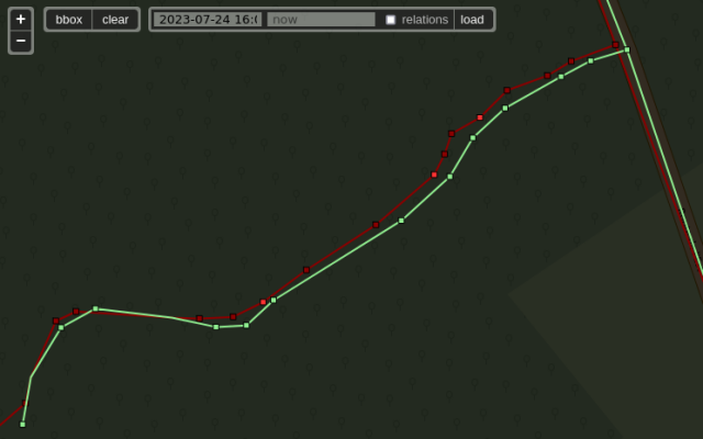
alors que l'imagerie de référence est BDOrtho IGN.
Fatigue...
https://wiki.openstreetmap.org/wiki/FR:Bonnes_pratiques#Alignez_les_images_a%C3%A9riennes_avant_toute_chose
#OpenStreetMap #OSM
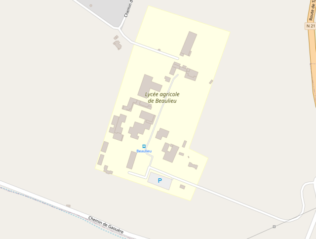
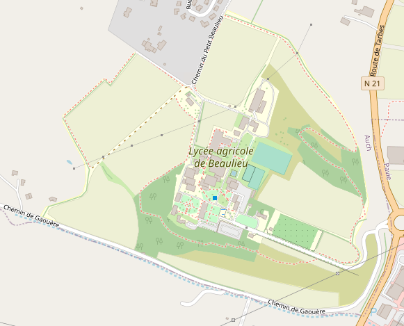
En mars dernier, une trentaine d'étudiantes et étudiants de la licence professionnelle Génie Géomatique pour l’Aménagement du territoire (GGAT 2) d’Auch ont réalisé une CartoPartie #OpenStreetMap sur le Lycée Agricole d’Auch.
https://forum.openstreetmap.fr/t/cartopartie-au-lycee-agricole-de-beaulieu/13917
cc @Bristow_69
CartoPartie au Lycée agricole de Beaulieu
Le mercredi 22 mars 2023, de 8h15 à 17h, 29 étudiants de la Licence professionnelle Génie Géomatique pour l’Aménagement du territoire (GGAT) d’Auch ont réalisé une CartoPartie sur le Lycée Agricole d’Auch (EPLEFPA - Beaulieu-Lavacant - Site de Beauli…Forum OSM France
* Ben Ritter: #OpenStreetMap’s big forking problem: OSM centrelines to full streets.
* Julien Perret: Towards the harmonization of digital field data entry for geological mapping: an in-house #QGIS #QField based template.
* Mark Jessell: Delivering data using #GeoServer with #TerriaMap and custom systems.
More info here: https://geogeeks.org/2023/0705_qfield-osm.html

Geogeeks Perth
Geogeeks is a Perth meetup group having fun with open geospatial, open source GIS, and OpenStreetMap.We're running a series of meetups and events to bring the Perth community together, and shine a light on what's happening in open geospatial.geogeeks.org
 .
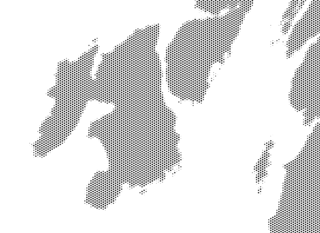
. Used a hex grid and the 'overlap analysis' tool to work out percentage overlap of grid cells/land. Dots then scaled in proportion to overlap
Using coastal data copyright #openstreetmap contributors
Performance tips: use 'subdivide' on land, buffer inward 1m (fixes geometries), split to singlepart, add spatial indexes to both layers. Now takes minutes, not hours
#qgis
J'obtiens une page vide...
cc @osm_fr
#OpenStreetMap #OSM
OSMobilizon - Mobilizon
Le lieu pour organiser des événements et créer ses groupes locaux d'OpenStreetMapOSMobilizon - Mobilizon
https://zelonewolf.github.io/openstreetmap-americana/#map=4/50.56/9.16&language=ga
#irish #gaeilge #map #maps #gischat #geo #ireland #OSM


