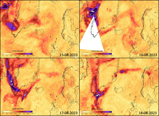
Smoke from the Canadian forest fires traveling eastward towards Greenland and Iceland as seen by the AIRS instrument onboard the #Aqua #NASA satellite. These images show carbon monoxide at the 500 hPa level. Units are part per billion by volume.
People in #gischat #EarthObservation and #RemoteSensing what are the best satellite products to follow smoke likes this besides the above. Aerosol depth perhaps?
People in #gischat #EarthObservation and #RemoteSensing what are the best satellite products to follow smoke likes this besides the above. Aerosol depth perhaps?

Ragnar Heiðar Þrastarson
in reply to Ragnar Heiðar Þrastarson • • •Workflow:
- Get data via Copernicus SciHub (pre-operations)
- Open NetCDF in SNAP, subset, reproject, export as #GeoTIFF
- Open in #QGIS add basemap, symbolize and export