Search
Items tagged with: remotesensing
We created this dataset by combining deep learning, remote sensing, and extensive field data to build models that can detect and classify individual trees. Models are almost 80% accurate and can be improved with additional field data collection.
https://jabberwocky.weecology.org/2023/11/13/data-on-100-million-individual-trees-in-the-national-ecological-observatory-network/
#ecology #RemoteSensing #DataScience
 The full site and surrounding region; 2) 500 m x 250 m; and 3) 90 m x 150m. The largest scale exhibits clusters and gradients of different colors. At the middle scale small boxes can be seen clustered by color. At the finest scales tree crowns can be seen surrounded by boxes of different colors.")
Data on 100 million individual trees in the National Ecological Observatory Network
We’re excited to announce the initial release of crown maps for 100 million trees in the National Ecological Observatory Network (NEON) with information on location, species identify, size, a…Jabberwocky Ecology

So make sure your data is correct.
With the future data validation environment DAVALIEN, you can ensure that the data you produce is correct and remains correct.
https://www.eomasters.org/davalien
#eo #remotesensing #earthobservation

"Fundamentals of #RemoteSensing"
Part 1: History & Practice https://zenodo.org/records/3265399
and
Part 2: Practice Book using #QGIS https://zenodo.org/records/6539257
#OSGeo #OpenSource #openbooks #GISChat
Fundamentals of remote sensing: history and practice
This Guidance Manual introduces readers to the history of development, physi‑cal basics and areas of application of the remote sensing data.Zenodo
--
https://www.nature.com/articles/s41598-023-42696-9 <-- shared paper
--
#GIS #spatial #mapping #remotesensing #InSAR #radar #deformation #NewMexico #aquifer #groundwater #waterresources #numericmodeling #model #modeling #injection #well #injectionwell #oilandgas #risk #hazard #grounddeformation #inducedseismicity #seismicity #surfacedeformation #waterresources #waterquality #watersecurity #water #hydrology
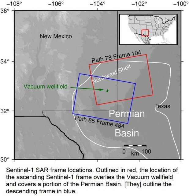
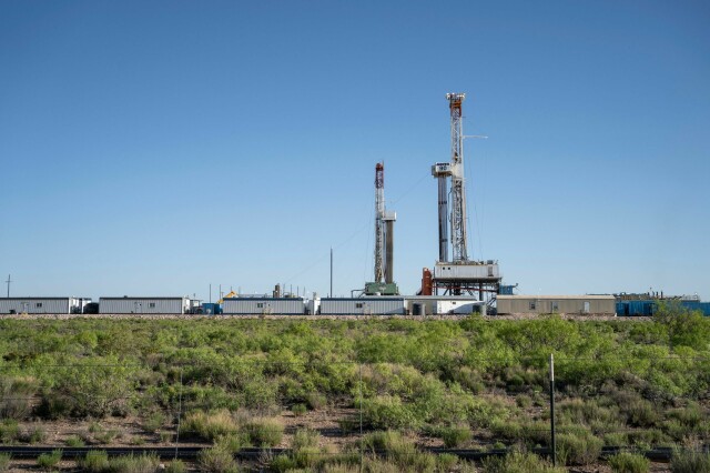
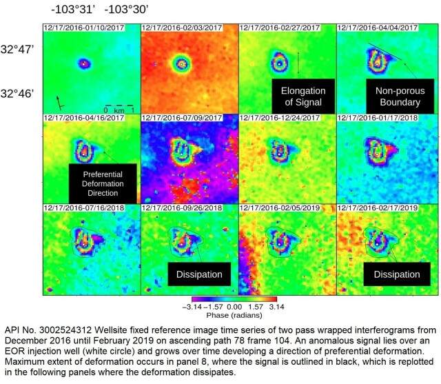
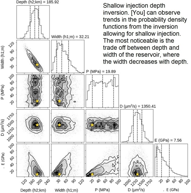
InSAR-observed surface deformation in New Mexico’s Permian Basin shows threats and opportunities presented by leaky injection wells - Scientific Reports
Scientific Reports - InSAR-observed surface deformation in New Mexico’s Permian Basin shows threats and opportunities presented by leaky injection wellsNature
Cloud-Based Remote Sensing with Google Earth Engine
https://link.springer.com/book/10.1007/978-3-031-26588-4
#remotesensing #gis

Cloud-Based Remote Sensing with Google Earth Engine
This open access book presents tools and techniques with Earth Engine, Google’s platform for planetary-scale satellite image analysis.SpringerLink
-updated tool for downloading #NASA Harmonized #Landsat and #Sentinel-2 images, as well as #Copernicus Sentinel-2 images.
-unified interface for preprocessing #remotesensing images
-updated classification tool including #machinelearning algorithms: Multi-Layer Perceptron, Support Vector Machine, and Random Forest through #scikitlearn and #PyTorch
https://fromgistors.blogspot.com/2023/09/road-to-semi-automatic-classification-images-classification.html

Road to the Semi-Automatic Classification Plugin v.8: Landsat and Sentinel-2 images download and preprocessing, classification
A blog that goes from GIS to Remote Sensing, tutorials for open source software, Land Cover, and the Semi-Automatic Classification Plugin for QGIS.fromgistors.blogspot.com

People in #gischat #EarthObservation and #RemoteSensing what are the best satellite products to follow smoke likes this besides the above. Aerosol depth perhaps?

https://r.iresmi.net/posts/2023/copernicus_openeo_ndvi_time_series/
#RemoteSensing #Sentinel2 #rspatial
 at 0.35; the deciduous forest shows the alternating seasons between 0.6 and 0.8; the corn fields shows the growing seasons until the harvest from 0.2 to 0.8.")
r.iresmi.net - Copernicus OpenEO NDVI time series
Use the OpenEO API to access Copernicus satellite datasetsr.iresmi.net
--
https://doi.org/10.3390/rs14184484 <-- shared paper
--
#GIS #spatial #mapping #satellitederivedbathymetry #SDB #nauticalcharting #machinelearning #IHOstandards #GEBCO #Seabed2030 #radiativetransferequation #RTE #remotesensing #satellite #model #modeling #hydrography #hydrospatial #marine #charts #navigation #nautical #gischat #bathymetry #topobathy #automation #ESA
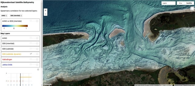
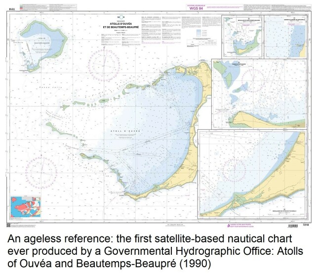
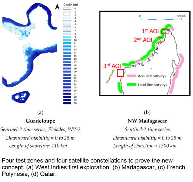
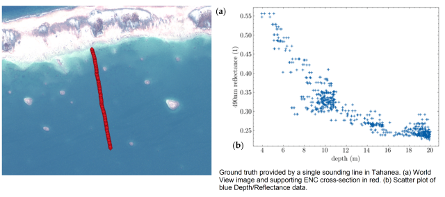
A New Approach to Satellite-Derived Bathymetry: An Exercise in Seabed 2030 Coastal Surveys
ARGANS has years of experience in analysing the factors limiting light transmission in coastal environments around the world.MDPI