Search
Items tagged with: openstreetmap
Please don't.
It is 100% #proprietary, Google has full control over the data you added and people can only access Google Maps over proprietary channels where Google dictates the rules. This gives them too much power.
Contribute to #OpenStreetMap instead, it's a project by the community, for the community.
https://www.openstreetmap.org
#OSM #GoogleMaps #PSA #scam #capitalism #OpenData

OpenStreetMap
OpenStreetMap is a map of the world, created by people like you and free to use under an open license.OpenStreetMap
#osm2pgsql #OSM #OpenStreetMap #GitHub #PostGIS #PostgreSQL
https://osm2pgsql.org/news/2023/09/20/new-github-organisation.html
#pgosm #postgis #postgres #postgresql #openstreetmap #gischat
https://github.com/rustprooflabs/pgosm-flex/releases/tag/0.10.2
Release 0.10.2 · rustprooflabs/pgosm-flex
PgOSM Flex 0.10.2 Commit hash: f45b3f6 The commit hash from this git repo shows up with the PgOSM Flex version number in SELECT pgosm_flex_version FROM osm.pgosm_flex; If you see this version wit...GitHub
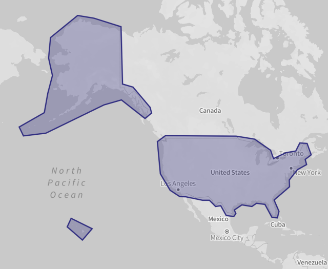
extracted this multipolygon from a 100GB planet #openstreetmap tileset served over HTTPS:
* zooms 0-15
* 15 million total tiles, ~15GB output
* 1000 HTTP requests
* 4 minutes download (60,000 tiles per second) across the ocean
GitHub - protomaps/go-pmtiles: Single-file executable tool for creating, reading and uploading PMTiles archives
Single-file executable tool for creating, reading and uploading PMTiles archives - GitHub - protomaps/go-pmtiles: Single-file executable tool for creating, reading and uploading PMTiles archivesGitHub
Panoramax
Panoramax fédère les initiatives (des collectivités, des contributeurs OSM, de l’IGN...) pour favoriser l'émergence d'un géocommun de bases de vues immersives.panoramax.fr
#Cartography #Maps #Geoviz #QGIS #OpenStreetMap
https://cartolab.at/cartography-on-mastodon/

richlv's Diary | A wonderful way to learn Overpass | OpenStreetMap
OpenStreetMap is a map of the world, created by people like you and free to use under an open license.OpenStreetMap
New frontend available on nominatim.openstreetmap.org
The rewritten search frontend of Nominatim has just been rolled out onOSM’s main instance https://nominatim.openstreetmap.org.Give it a try.nominatim.org

![Panoramax L'alternativa libera per foto cartografare il territorio. Come funziona? Panoramax federa le iniziative (delle collettività, dei contributori OSM, dell'IGN [Istituto nazionale di informazione geografica e forestale]) per favorire la creazione di un bene comune geografico costituito da una base di viste immersive. Panoramax L'alternativa libera per foto cartografare il territorio. Come funziona? Panoramax federa le iniziative (delle collettività, dei contributori OSM, dell'IGN [Istituto nazionale di informazione geografica e forestale]) per favorire la creazione di un bene comune geografico costituito da una base di viste immersive.](https://friendica.opencloud.lu/photo/preview/640/221017)