Search
Items tagged with: movementdataanalytics
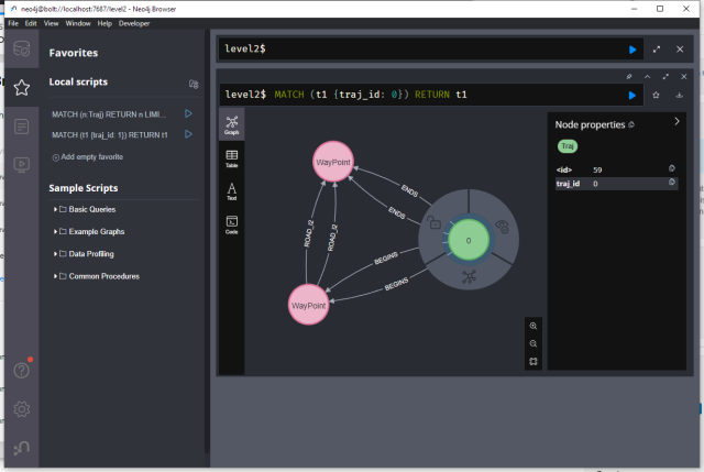
Dabbling in #neo4j today, exploring Maryam M. Elayam's hierarchical graph-based model for mobility data https://zenodo.org/records/6405212
#MovementDataAnalytics #MobilityDataScience #GraphDatabase #GraphAnalytics
#MovementDataAnalytics #MobilityDataScience #GraphDatabase #GraphAnalytics
A hierarchical graph-based model for mobility data representation and analysis
Hierarchical representations of transportation networks should provide a better understanding of mobility patterns and the underlying structures at various abstraction levels.Zenodo
The materials of my #MovementDataAnalytics with #MovingPandas and #DVC are openly available at:
https://github.com/movingpandas/movingpandas-examples/tree/opengeohub2023
The session recording will be made available as well, in the near future. Follow @opengeohub for updates
https://github.com/movingpandas/movingpandas-examples/tree/opengeohub2023
The session recording will be made available as well, in the near future. Follow @opengeohub for updates

GitHub - movingpandas/movingpandas-examples at opengeohub2023
Example notebooks illustrating MovingPandas use cases - GitHub - movingpandas/movingpandas-examples at opengeohub2023GitHub
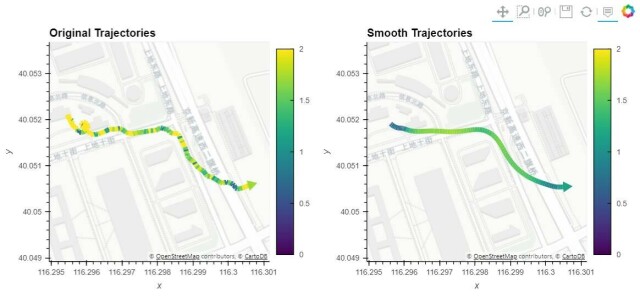
Getting ready for the next #MovingPandas release 0.17 with more trajectory cleaning features than ever before 😉
#MobilityScience #MovementDataAnalytics #SpatialDataScience
#MobilityScience #MovementDataAnalytics #SpatialDataScience
Very interesting ✈️ patterns here:
Visualisation of all civil flights over #Ireland on 22th of May 2018 from 00-24h by #Flickr user neboysh
- Data source:
#ARTAS (Air traffic management surveillance tracker and server), 4002 unique #flights extracted from 3 million #GPS tracking points
- Software: #QGIS 3.2.1
https://flickr.com/photos/10169636@N07/42565210515/in/pool-qgis/
#Dataviz #mapping #gischat #aviation #MobilityAnalytics #MovementDataAnalytics
Visualisation of all civil flights over Ireland on 22th of May 2018 from 00-24h
- Data source: ARTAS (Air traffic management surveillance tracker and server), 4002 unique flights extracted from 3 million GPS tracking points - Software: QGIS 3.2.1Flickr
New #bicycle 🚴 track analytics demo key topics are:
1️⃣ Using @movingpandas with local image coordinates
2️⃣ Georeferencing video-based trajectories using @qgis VectorBender plugin
https://anitagraser.com/2023/05/21/analyzing-video-based-bicycle-trajectories/
#bicycle tracks extracted from #video footage 🎥 courtesy of @mszll
#QGIS #GISChat #MobilityAnalytics #mobility #datascience #MovementDataAnalytics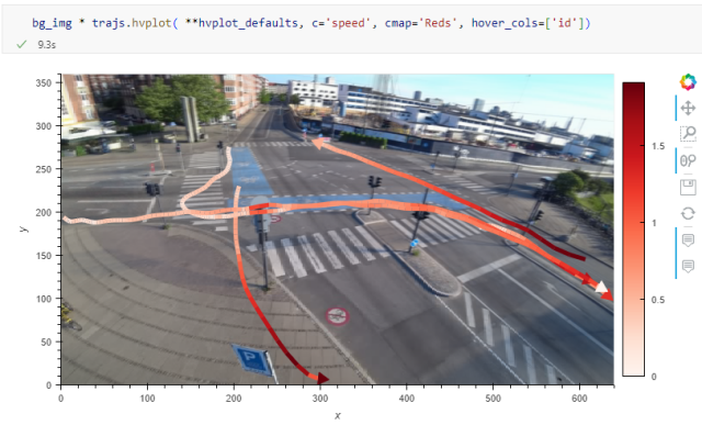

Analyzing video-based bicycle trajectories
Did you know that MovingPandas also supports local image coordinates? Indeed, it does. In today’s post, we will explore how we can use this feature to analyze bicycle tracks extracted from vi…Free and Open Source GIS Ramblings
