Search
Items tagged with: maps

In a band, the geopeople are the bass-players - GeoHipster
Erik Meerburg has been working in geo-information for over 25 years. Education in geo and promotion of the use of geo are his focus.rjhale1971 (GeoHipster)
 👋
👋 I just moved here from Twitter, let's connect and see you soon in the #30DayMapChallenge 😄
#gischat #map #maps #cartography
https://www.data.gv.at/katalog/dataset/4030d796-0573-4305-86f2-b34e38a86a1d#resources
Franziszeischer Kataster Wien - data.gv.at
Digitalisierte Katastralpläne der Stadt Wien 1817 bis 1829.www.data.gv.at
https://www.geohipster.com/2023/09/12/2024-geohipster-calendar/
2024 Geohipster Calendar - GeoHipster
The 2024 Geohipster Calendar is announced. You have til 20231027 to get it submitted. This is the 11th calendar we've published.rjhale1971 (GeoHipster)
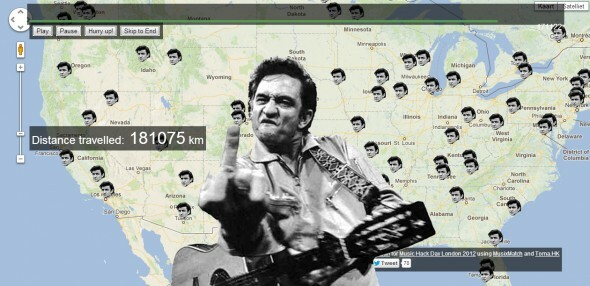
https://www.johnnycashhasbeeneverywhere.com/
#maps #CountryMusic #JohnnyCash
https://youtu.be/EHWCJRapWCE?si=Gpfm-1aBKfJ0BMcX
#gischat #maps #mapping

QGIS User 0051 - Open Polygon Style
I made a style in the QGIS Hub that I explain how to use in this video.The style draws outlines but not ends for polygons drawn according to some rules. You ...YouTube
#geography #geolocation #maps
-
Null Island Is a Fake Island Where the Prime Meridian and Equator Meet - Atlas Obscura
https://www.atlasobscura.com/articles/strange-maps-null-island
The Center of the Earth Has an Imaginary Island and One Floating Soul
Fact and fiction blend together at zero latitude and zero longitude.Frank Jacobs, Big Think (Atlas Obscura)

2024 Geohipster Calendar - GeoHipster
The 2024 Geohipster Calendar is announced. You have til 20231027 to get it submitted. This is the 11th calendar we've published.rjhale1971 (GeoHipster)
#GIS #GISchat
By the way: This is a screenshot of the #A20. One of the most environmentally and #climate damaging #highway projects in #Germany.

