Search
Items tagged with: gis
Exploring the technicalities of localizing #OpenSource software:
in my blog post I explain how we use #Weblate for translating #GRASSGIS.
A detailed look at how translation management systems can streamline localization workflows in open-source projects. 🌐💻
Check out at https://neteler.org/blog/translating-with-weblate/ #GIS #Localization #TechTalk #OSGeo #FOSS4G

Translating Open Source Software with Weblate: A GRASS GIS Case Study - Markus Neteler Consulting
Simplifying the translation process of software projects like GRASS GIS with Weblate, an open source translation management system, is shown here.Markus (Markus Neteler Consulting)

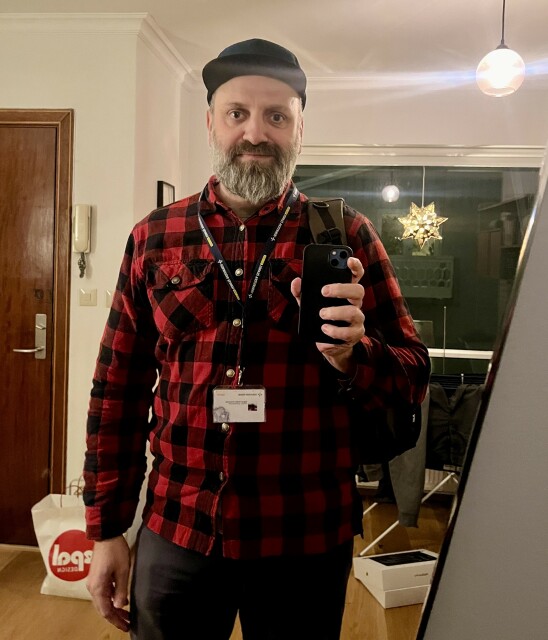
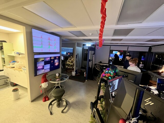
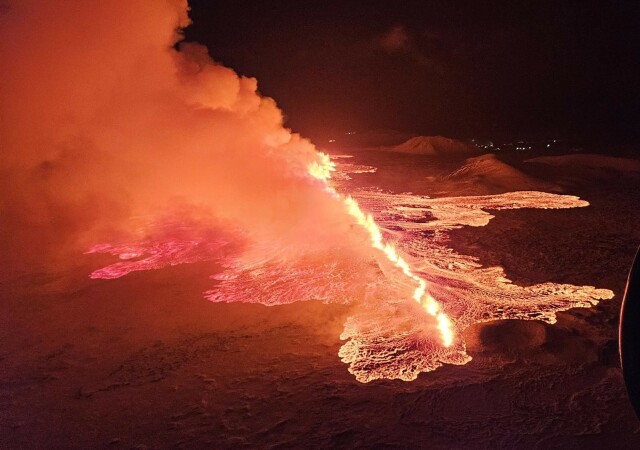
The fourth eruption on the Reykjanes peninsula started at 22:17 this evening. I anticipate a long night and lots of #GIS work here at the Icelandic Met Office.
Photos:
- Kids asleep, getting back to work
- IMO monitoring room
- Image from a colleague hovering above the eruption
Now with the proper subtitles! (Google was not very good with the autogenerated ones).
The slides in PDF are available in my web page.
#FOSS4G #foss4g2023 #GIS #coordinatesystems

2023 | Introduction to Coordinate Systems - Javier Jimenez Shaw
FOSS4G 2023 PrizrenIntroduction to basic but important concepts about Coordinate Reference Systems (what is doable in 20 min ) - Geographic Coordinate (Re...YouTube
#gischat #geo #gis
https://github.com/JakobMiksch/go-geospatial

GitHub - JakobMiksch/go-geospatial: A collection of geospatial tools and libraries written in Go
A collection of geospatial tools and libraries written in Go - GitHub - JakobMiksch/go-geospatial: A collection of geospatial tools and libraries written in GoGitHub
The app allows you to easily create styles for vector datasets based on the Mapbox Style Specification. You can host the styles on a server and easily import them into your #geo #webapp running #openlayers, #leaflet or any other library that supports style json's.
I worked on implementing styling based on property filters. Check out demo below.
It's work in progress. Will put this online in near future.
#gischat #OGC #gis #buildinpublic
Reached the end of the line with your #GeoPandas plots? Replace them with maps rendered by QGIS.
http://anitagraser.com/2023/11/10/bringing-qgis-maps-into-jupyter-notebooks/
#maps #GISChat #DataScience #SpatialDataScience #DataViz #GIS

Bringing QGIS maps into Jupyter notebooks
Earlier this year, we explored how to use PyQGIS in Juypter notebooks to run QGIS Processing tools from a notebook and visualize the Processing results using GeoPandas plots. Today, we’ll go …Free and Open Source GIS Ramblings
"Fundamentals of #RemoteSensing"
Part 1: History & Practice https://zenodo.org/records/3265399
and
Part 2: Practice Book using #QGIS https://zenodo.org/records/6539257
#OSGeo #OpenSource #openbooks #GISChat
Fundamentals of remote sensing: history and practice
This Guidance Manual introduces readers to the history of development, physi‑cal basics and areas of application of the remote sensing data.Zenodo
(Yes there is a ton of "coordinate converter" apps out there, but their UI is far too overloaded for my purposes.)
https://cartolab.at/coords/
Source code is available at https://github.com/floledermann/coordinates
#gis #gischat


GitHub - floledermann/coordinates: Simple web app to show geo coordinates in two different coordinate reference systems
Simple web app to show geo coordinates in two different coordinate reference systems - GitHub - floledermann/coordinates: Simple web app to show geo coordinates in two different coordinate referenc...GitHub
