Search
Items tagged with: infrastructure
Update. More on the EC plan for Open Research Europe (#ORE) to adopt an #OpenSource core.
https://op.europa.eu/en/publication-detail/-/publication/3603e219-6a65-11ef-a8ba-01aa75ed71a1/language-en
See §2.4.5. "ORE will be underpinned by an #OpenSource software #infrastructure, the core elements of which will be developed with the support of the Commission and will follow #OpenStandards. Its infrastructure will be in line with the Principles for Open Scholarly Infrastructure [#POSI] and with the Open Source Software Strategy of the European Commission."

Open research Europe - Publications Office of the EU
This report puts forward a vision for Open Research Europe as a collective non-profit open access publishing service for the public good.Publications Office of the EU

I've found you can attach your iPhone to your bike and generate LiDAR point clouds of the kerb and cycleway infrastructure if you go slow!
https://jakecoppinger.com/2023/03/generating-aerial-imagery-with-your-iphones-lidar-sensor/
#lidar #openstreetmap #maps #iphone #openaerialmap #cycling #infrastructure #urbanism #sydney #australia #betterstreets #opendronemap #odm #webodm
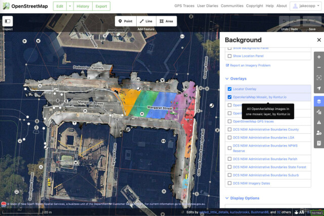
Generating aerial imagery with your iPhone’s LiDAR sensor - Jake Coppinger
This technical guide details how you can create your own aerial imagery and 3D models of streets with the built in iPhone LiDAR sensor and open source tools in the OpenDroneMap package.https://jakecoppinger.com/author/jakcop_t1chd5/#author (Jake Coppinger)