Search
Items tagged with: cycling
Ce l’abbiamo fatta, nonostante i 14’ di ritardo, il nostro ultimo treno ha aspettato la coincidenza.
Bologna arriviamo 🥳
This is the event
🔗 https://balotta.org/event/ciemmona-2024-1
#criticalmass #ciemmona #ciemmona2024 #cycling #bologna

Ciemmona 2024
Sabato 1 giugno – 14.30 Ciemmona, parco Don Bosco (ingresso via A. Moro) – invadiamo la città! Il 31 maggio, l’1 e il 2 giugno Bologna è pronta ad accogliere un’ondata di gioia a pedali, un’invasione di biciclette, monocicli, tricicli, skate e quals…Balotta
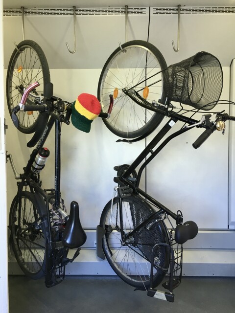
As soon as we woke up, we said to ourselves...we have 40' to get ready...et ualaà, without any preparation we set off with our chariots, hanging like salamis.
Bologna we are coming! #ciemmona2024
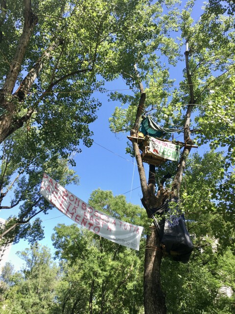
“Cementificare”
La costante di questa classe dirigente insostenibile
Nel centro di Bologna difendono il loro parco, il loro piccolo polmone verde, fresco e accogliente costruendo case sugli alberi.
Poveri noi 💪
#criticalmass #ciemmona #ciemmona2024 #cycling #bologna #climatechange #nopassante
https://youtu.be/LP6oKEUgX30
#qgis #gischat #mobility #cycling #MobilityAnalytics #objecttracking

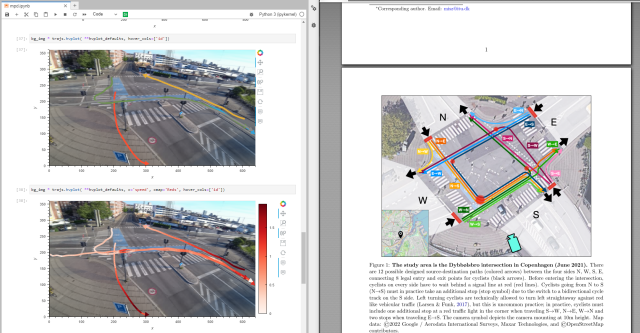
Georeferencing video-based bicycle trajectories using QGIS VectorBender plugin
VectorBender: https://plugins.qgis.org/plugins/VectorBender/Dataset: https://zenodo.org/record/7288616Data description: https://arxiv.org/abs/2211.01301YouTube
Currently working on a demo using #bicycle tracks extracted from #video footage 🚴🎥 published by @mszll
https://arxiv.org/abs/2211.01301
#openscience #MobilityAnalytics #MobilityDataScience #mobility #MovingPandas #TrafficFlow #planning #cycling #TrafficBehavior
Computational Desire Line Analysis of Cyclists on the Dybbølsbro Intersection in Copenhagen
Contemporary street design prioritizes vehicular traffic flow and assumes compliant road users. However, actual human behavior is typically neglected, especially of cyclists, leading to streets with inadequate wayfinding and protection from vehicular…arXiv.org
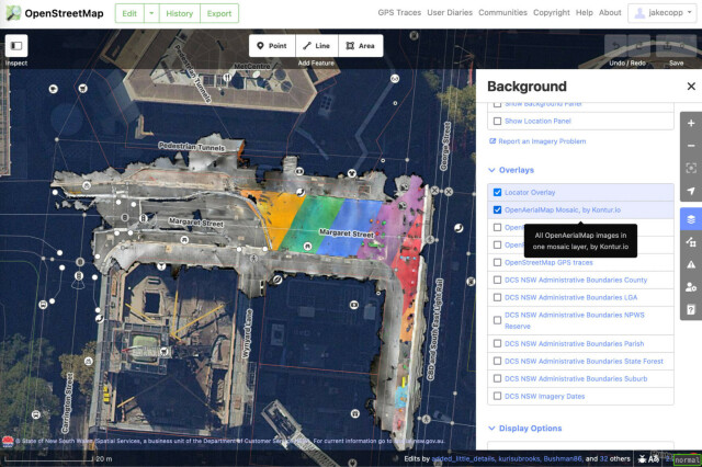
I've found you can attach your iPhone to your bike and generate LiDAR point clouds of the kerb and cycleway infrastructure if you go slow!
https://jakecoppinger.com/2023/03/generating-aerial-imagery-with-your-iphones-lidar-sensor/
#lidar #openstreetmap #maps #iphone #openaerialmap #cycling #infrastructure #urbanism #sydney #australia #betterstreets #opendronemap #odm #webodm
Generating aerial imagery with your iPhone’s LiDAR sensor - Jake Coppinger
This technical guide details how you can create your own aerial imagery and 3D models of streets with the built in iPhone LiDAR sensor and open source tools in the OpenDroneMap package.https://jakecoppinger.com/author/jakcop_t1chd5/#author (Jake Coppinger)

