Search
Items tagged with: WebODM
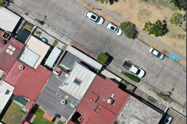
My own #3DTiles generated in #WebODM on the new #QGIS  3.34 #Prizren #GIS 🗺
#drones #mavic3 #Guadalajara #photogrammetry #structurefrommotion #SfM #odm #opendronemap #CesiumJS
 3.34 #Prizren #GIS 🗺
#drones #mavic3 #Guadalajara #photogrammetry #structurefrommotion #SfM #odm #opendronemap #CesiumJS
Tomorrow at the University of Guanajuato, within the "Engineering Week" event, I will be presenting, as part of the Official QGIS Mexico User Group  , the #GIS
  of the Government of #Guadalajara 🇲🇽 done in the last two years of work (Only the new developments)
Using #FOSS geospatial
#QGIS #Potree #PostGIS #Geoserver #Leaflet #OpenDroneMap #WebODM #WhiteboxTools #Lastools #CloudCompare #GeoSAM
For #LiDAR #webmapping #drones #photogrammetry #cadastral #survey #AI #mobility
 , the #GIS
  of the Government of #Guadalajara 🇲🇽 done in the last two years of work (Only the new developments)
Using #FOSS geospatial

#QGIS #Potree #PostGIS #Geoserver #Leaflet #OpenDroneMap #WebODM #WhiteboxTools #Lastools #CloudCompare #GeoSAM
For #LiDAR #webmapping #drones #photogrammetry #cadastral #survey #AI #mobility
Spent last night processing some orthos using the latest #webodm version and the results look amazing. Installing all the dependencies on #pop_os to run the webodm gpu docker version was pretty straight forward thanks to the Pop!_OS documentation.
The work the #odm team is doing is simply amazing. They're enabling so much people carry out their projects without getting stuck in proprietary solutions. Thank you!
Ortho details: 1.7 cm, 70 m AGL, double grid (pix4d capture)
#dji #mavic2pro
The work the #odm team is doing is simply amazing. They're enabling so much people carry out their projects without getting stuck in proprietary solutions. Thank you!
Ortho details: 1.7 cm, 70 m AGL, double grid (pix4d capture)
#dji #mavic2pro
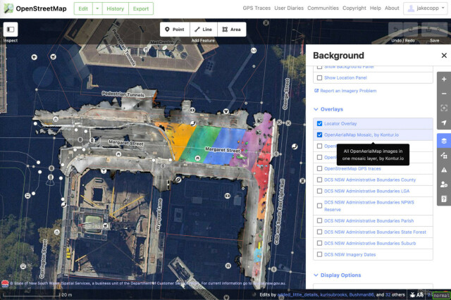
I wrote a technical guide on how you can create your own aerial imagery and 3D models of streets with the built in iPhone LiDAR sensor and open source tools in the OpenDroneMap package.
I've found you can attach your iPhone to your bike and generate LiDAR point clouds of the kerb and cycleway infrastructure if you go slow!
https://jakecoppinger.com/2023/03/generating-aerial-imagery-with-your-iphones-lidar-sensor/
#lidar #openstreetmap #maps #iphone #openaerialmap #cycling #infrastructure #urbanism #sydney #australia #betterstreets #opendronemap #odm #webodm
Generating aerial imagery with your iPhone’s LiDAR sensor - Jake Coppinger
This technical guide details how you can create your own aerial imagery and 3D models of streets with the built in iPhone LiDAR sensor and open source tools in the OpenDroneMap package.https://jakecoppinger.com/author/jakcop_t1chd5/#author (Jake Coppinger)
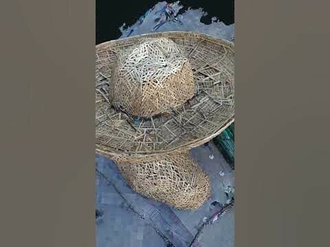
""El Charro" in Guadalajara - WebODM" in YouTube https://youtube.com/shorts/S5HBoHLFXR0?feature=share
El Charro sculpture, 3d model created with Opendronemap and a Mavic 2 Pro. Author: Hennessy Becerra
@OpenDroneMap #WebODM #3d #Potree #drones
El Charro sculpture, 3d model created with Opendronemap and a Mavic 2 Pro. Author: Hennessy Becerra
@OpenDroneMap #WebODM #3d #Potree #drones
"El Charro" en Guadalajara - WebODM
Escultura "El Charro".Con motivo de los 481 años de Guadalajara y 200 de Jalisco en México, se realiza esta escultura hecha en madera.Vuelo/escaneo con Mavic...YouTube


