Search
Items tagged with: drones
My own #3DTiles generated in #WebODM on the new #QGIS  3.34 #Prizren #GIS 🗺
#drones #mavic3 #Guadalajara #photogrammetry #structurefrommotion #SfM #odm #opendronemap #CesiumJS
 3.34 #Prizren #GIS 🗺
#drones #mavic3 #Guadalajara #photogrammetry #structurefrommotion #SfM #odm #opendronemap #CesiumJS
Tomorrow at the University of Guanajuato, within the "Engineering Week" event, I will be presenting, as part of the Official QGIS Mexico User Group  , the #GIS
  of the Government of #Guadalajara 🇲🇽 done in the last two years of work (Only the new developments)
Using #FOSS geospatial
#QGIS #Potree #PostGIS #Geoserver #Leaflet #OpenDroneMap #WebODM #WhiteboxTools #Lastools #CloudCompare #GeoSAM
For #LiDAR #webmapping #drones #photogrammetry #cadastral #survey #AI #mobility
 , the #GIS
  of the Government of #Guadalajara 🇲🇽 done in the last two years of work (Only the new developments)
Using #FOSS geospatial

#QGIS #Potree #PostGIS #Geoserver #Leaflet #OpenDroneMap #WebODM #WhiteboxTools #Lastools #CloudCompare #GeoSAM
For #LiDAR #webmapping #drones #photogrammetry #cadastral #survey #AI #mobility
#RogerWaters,a living legend, educates the public on #drones,#Palestine, Julian #Assange.
We just met in #Bologna and I gave him my book #SecretPower based on 13 years on my investigative work on Julian #Assange and #WikiLeaks.
He has endorsed my book #SecretPowerWikiLeaksandItsEnemies: "To read it is to resist"
We just met in #Bologna and I gave him my book #SecretPower based on 13 years on my investigative work on Julian #Assange and #WikiLeaks.
He has endorsed my book #SecretPowerWikiLeaksandItsEnemies: "To read it is to resist"
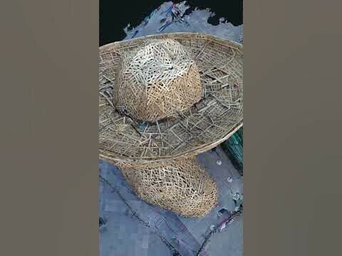
""El Charro" in Guadalajara - WebODM" in YouTube https://youtube.com/shorts/S5HBoHLFXR0?feature=share
El Charro sculpture, 3d model created with Opendronemap and a Mavic 2 Pro. Author: Hennessy Becerra
@OpenDroneMap #WebODM #3d #Potree #drones
El Charro sculpture, 3d model created with Opendronemap and a Mavic 2 Pro. Author: Hennessy Becerra
@OpenDroneMap #WebODM #3d #Potree #drones
"El Charro" en Guadalajara - WebODM
Escultura "El Charro".Con motivo de los 481 años de Guadalajara y 200 de Jalisco en México, se realiza esta escultura hecha en madera.Vuelo/escaneo con Mavic...YouTube


