Search
Items tagged with: spatial
SVG REPO: 500 000+ free icons! +66% https://geoobserver.wordpress.com/2023/05/22/svg-repo-500-000-free-icons-66/ #svg #icon #qgis #switch2qgis #gistribe #gischat #fossgis #foss4g #OSGeo #DataViz #opensource #spatial #geospatial #mapping#gis #geo #geo Observer via @svgrepo @Luiseperezg
SVG REPO: 500 000+ free icons! +66%
Screenshot: 500000+ freie SVGs (Quelle [1]) In meinem Beitrag vom Sommer 2022 [1] hatte ich Euch bereits die faszinierende 300000 SVG-Symbole beinhaltende SVG REPO-Sammlung [2] vorgestellt. In weni…#geoObserver
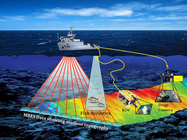
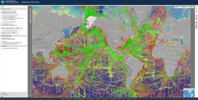
Bathymetric Data Viewer [global, NOAA]
--
https://www.ncei.noaa.gov/maps/bathymetry/ <-- spatial open data web portal
--
“NCEI and the IHO Data Center for Digital Bathymetry (DCDB) archive and share depth data acquired by hydrographic, oceanographic, and industry vessels and platforms during surveys or while on passage. These data, which are used in several national and international mapping bathymetry projects, are free to the public with no restrictions…”
#GIS #spatial #mapping #remotesensing #bathmetry #global #opendata #openaccess #download #NCEI #DCBD #NOAA #elevation #sonar #water #hydrography #hydrospatial #webportal #science #spatialanalysis #DEM #data #digital #multibeam #survey #visualisation #BAG #raster #GEBCO #GMRT #IBSCO #GSHHG
@NOAA @NCEI @GEBCO
--
https://www.ncei.noaa.gov/maps/bathymetry/ <-- spatial open data web portal
--
“NCEI and the IHO Data Center for Digital Bathymetry (DCDB) archive and share depth data acquired by hydrographic, oceanographic, and industry vessels and platforms during surveys or while on passage. These data, which are used in several national and international mapping bathymetry projects, are free to the public with no restrictions…”
#GIS #spatial #mapping #remotesensing #bathmetry #global #opendata #openaccess #download #NCEI #DCBD #NOAA #elevation #sonar #water #hydrography #hydrospatial #webportal #science #spatialanalysis #DEM #data #digital #multibeam #survey #visualisation #BAG #raster #GEBCO #GMRT #IBSCO #GSHHG
@NOAA @NCEI @GEBCO
GeoServer released: v2.23.0 https://geoobserver.wordpress.com/2023/04/07/geoserver-released-v2-23-0/ #geoserver #gistribe #gischat #fossgis #foss4g #OSGeo #opensource #spatial #geospatial #gis #geo #geoObserver
GeoServer released: v2.23.0
Screenshot: Ankündigung GeoServer v2.23.0 (Quelle [1]) Die GeoServer-Community hat am 05.04.2023 über die Mailingliste [1] die Version 2.23.0 [2] bekannt gegeben. Details über die Neuerungen und Bu…#geoObserver
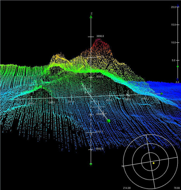
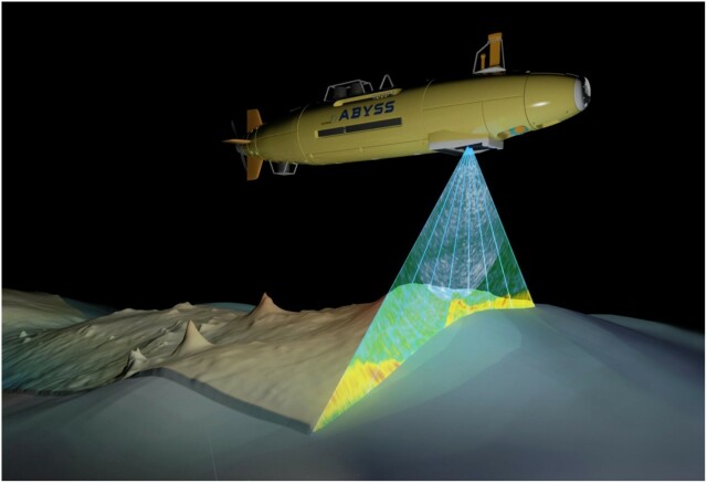
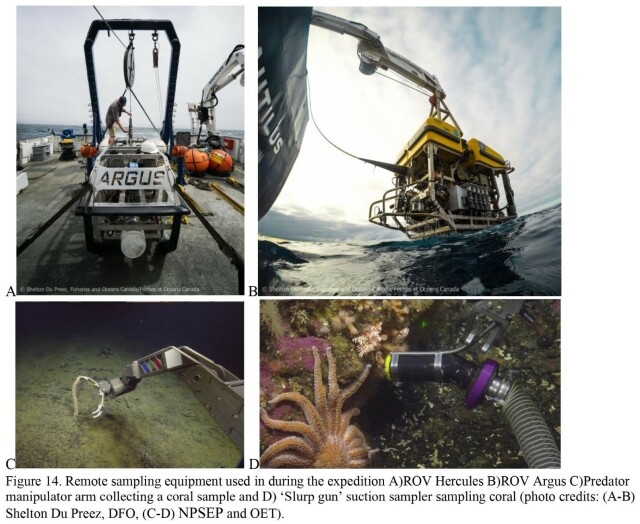
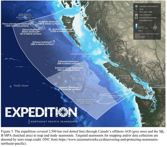
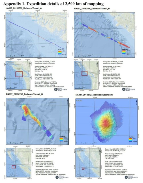
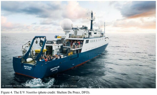
Pacific Seamounts 2018 Expedition Report [British Columbia, Canada]
--
https://publications.gc.ca/collections/collection_2022/mpo-dfo/Fs97-6-3460-eng.pdf <-- their shared report as a PDF
--
[Tang.ɢwan – ḥačxwiqak – Tsig̱is Area of Interest (TḥT AOI)]
#environmental #marine #mining #data #management #environment #biodiversity #canada #offshore #GIS #spatial #mapping #remotesensing #sonar #bathymetry #bathymetric #britishcolumbia #seafloor #seamounts #HaidaNation #NPSEP #ocean #oceanconservation #oceanography #survey #expedition #research #rov #underwater
Fisheries and Oceans Canada
--
https://publications.gc.ca/collections/collection_2022/mpo-dfo/Fs97-6-3460-eng.pdf <-- their shared report as a PDF
--
[Tang.ɢwan – ḥačxwiqak – Tsig̱is Area of Interest (TḥT AOI)]
#environmental #marine #mining #data #management #environment #biodiversity #canada #offshore #GIS #spatial #mapping #remotesensing #sonar #bathymetry #bathymetric #britishcolumbia #seafloor #seamounts #HaidaNation #NPSEP #ocean #oceanconservation #oceanography #survey #expedition #research #rov #underwater
Fisheries and Oceans Canada
