Search
Items tagged with: risk
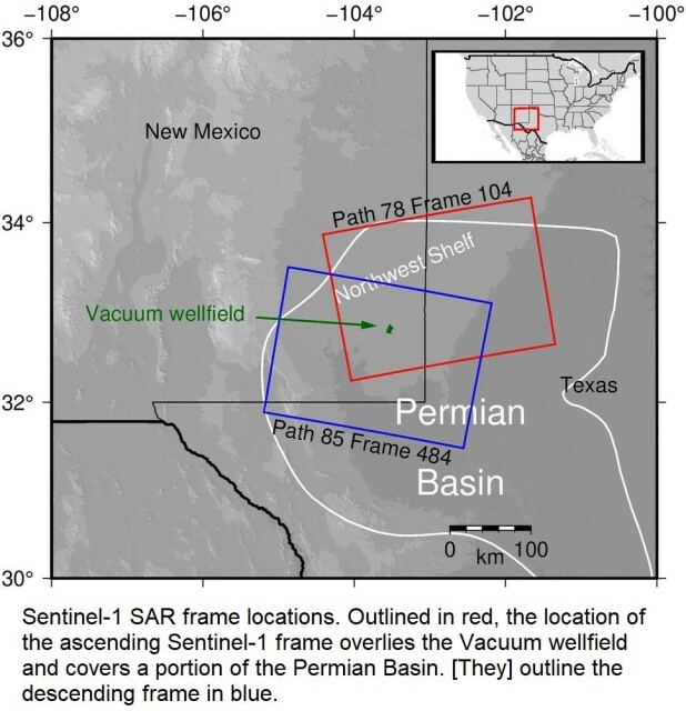
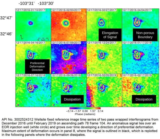
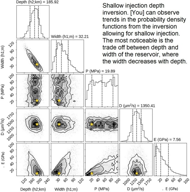
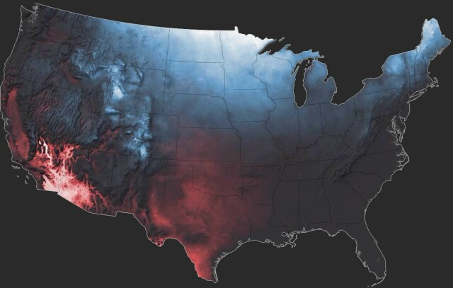
InSAR-Observed Surface Deformation In New Mexico’s Permian Basin Shows Threats And Opportunities Presented By Leaky Injection Wells [remote sensing]
--
https://www.nature.com/articles/s41598-023-42696-9 <-- shared paper
--
#GIS #spatial #mapping #remotesensing #InSAR #radar #deformation #NewMexico #aquifer #groundwater #waterresources #numericmodeling #model #modeling #injection #well #injectionwell #oilandgas #risk #hazard #grounddeformation #inducedseismicity #seismicity #surfacedeformation #waterresources #waterquality #watersecurity #water #hydrology
--
https://www.nature.com/articles/s41598-023-42696-9 <-- shared paper
--
#GIS #spatial #mapping #remotesensing #InSAR #radar #deformation #NewMexico #aquifer #groundwater #waterresources #numericmodeling #model #modeling #injection #well #injectionwell #oilandgas #risk #hazard #grounddeformation #inducedseismicity #seismicity #surfacedeformation #waterresources #waterquality #watersecurity #water #hydrology
InSAR-observed surface deformation in New Mexico’s Permian Basin shows threats and opportunities presented by leaky injection wells - Scientific Reports
Scientific Reports - InSAR-observed surface deformation in New Mexico’s Permian Basin shows threats and opportunities presented by leaky injection wellsNature

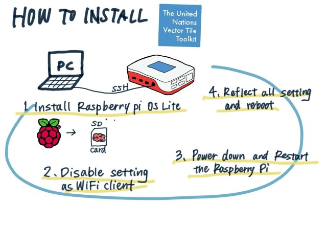
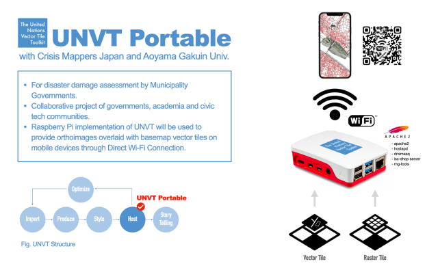
UNVT Portable - Portable MapServers For Disaster Response
--
https://github.com/unvt/portable
--
" ‘UNVT Portable’ is a package for RaspberryPi that functions as a map hosting server and can be freely accessed from a web browser within a local network.
It is mainly intended to function in an offline environment during times of severe disaster, and is expected to play an active role... where disaster response headquarters are set up to assess the situation and respond to disasters by combining aerial drone images taken after a disaster occurs with OpenStreetMap and various open data tile data sets prepared in advance…”
#GIS #spatial #mapping #gischat #portable #mapserver #raspberrypi #raspberry #hosting #server #webbrowser #localnetwork #onsite #disasterresponse #hardware #solution #opensource #openformat #responsecenter #disasterresponsecenter #headquarters #readyresponse #mobile #mobileoffice #emergencyresponse #emergencymanagement #emergencypreparedness #risk #hazard #onlinemapping
--
https://github.com/unvt/portable
--
" ‘UNVT Portable’ is a package for RaspberryPi that functions as a map hosting server and can be freely accessed from a web browser within a local network.
It is mainly intended to function in an offline environment during times of severe disaster, and is expected to play an active role... where disaster response headquarters are set up to assess the situation and respond to disasters by combining aerial drone images taken after a disaster occurs with OpenStreetMap and various open data tile data sets prepared in advance…”
#GIS #spatial #mapping #gischat #portable #mapserver #raspberrypi #raspberry #hosting #server #webbrowser #localnetwork #onsite #disasterresponse #hardware #solution #opensource #openformat #responsecenter #disasterresponsecenter #headquarters #readyresponse #mobile #mobileoffice #emergencyresponse #emergencymanagement #emergencypreparedness #risk #hazard #onlinemapping
GitHub - unvt/portable: UNVT Portable
UNVT Portable. Contribute to unvt/portable development by creating an account on GitHub.GitHub