Search
Items tagged with: qgis
Anyway, here's my bad map titled 'All the Scots in Scotland' which shows all places with 'scot' in their name. And yes, I have used Irn Bru colours, what's your problem? 😉
Data came from #OpenStreetMap Made in #QGIS and #inkscape
#Scotland #maps #irnbru
")

"Fundamentals of #RemoteSensing"
Part 1: History & Practice https://zenodo.org/records/3265399
and
Part 2: Practice Book using #QGIS https://zenodo.org/records/6539257
#OSGeo #OpenSource #openbooks #GISChat
Fundamentals of remote sensing: history and practice
This Guidance Manual introduces readers to the history of development, physi‑cal basics and areas of application of the remote sensing data.Zenodo
https://youtu.be/NwL2f5Nrn3U

Downloading free satellite images using the Semi-Automatic Classification Plugin
Downloading free satellite images using the Semi-Automatic Classification Plugin: the Download product tabSCP Websitehttps://fromgistors.blogspot.com/p/semi-...YouTube

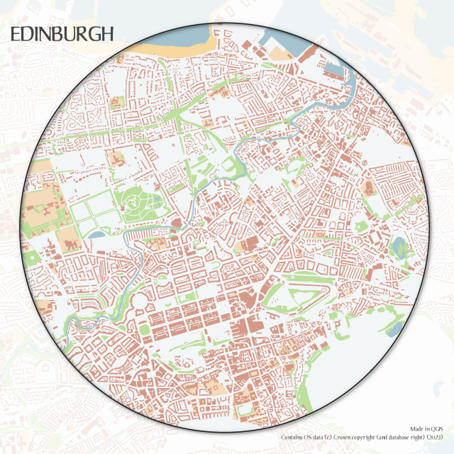
Centre of Edinburgh - OS Open Zoomstack polygon layers
#OSOpen #QGIS
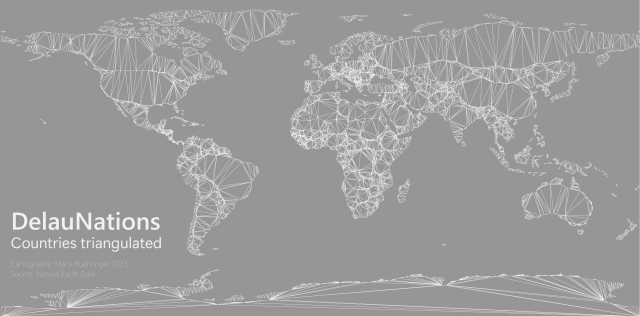
DelauNations - A Delaunay triangulation of country borders 📐🗺️
Tools: #QGIS
Data: Natural Earth
#gischat

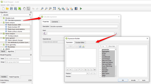
One highlight: New ‘Calculate expression’ algorithm for use in models
The new “Calculate expression” algorithm will calculate the results of a QGIS expression and make the result available for use in other parts of the model.
It avoids the need to use the same expression multiple times throughout a model if the same result needs to be used more than once and provides additional use cases.
https://www.qgis.org/en/site/forusers/visualchangelog334/index.html