Search
Items tagged with: Openstreetmap
https://framaforms.org/proposition-dintervention-au-sotm-france-2023-1675807136
#sotm #osm #marseille #sotm2023
#FreeSoftware #FLOSS #OpenData #OpenStreetMap #cartography #maps

MapLibre (@maplibre@mastodon.social)
1 Post, 0 Following, 11 Followers · Open-source mapping libraries for web and mobile app developers.Mastodon
"Consultation on Fundraising Strategy:" submit your ideas, questions, concerns until March 22.
https://community.openstreetmap.org/t/consultation-on-fundraising-strategy/96988?u=courtiney
#OpenStreetMap #OSM #OSMF #OpenStreetMapFoundation #funding
Consultation on fundraising strategy
For 2023, the OSMF Board has decided to target a balanced budget. Given our expected income and expenses, there is a gap of approximately 500K GBP that we need to fundraise for. https://wiki.osmfoundation.OpenStreetMap Community
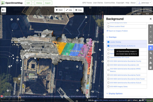
I've found you can attach your iPhone to your bike and generate LiDAR point clouds of the kerb and cycleway infrastructure if you go slow!
https://jakecoppinger.com/2023/03/generating-aerial-imagery-with-your-iphones-lidar-sensor/
#lidar #openstreetmap #maps #iphone #openaerialmap #cycling #infrastructure #urbanism #sydney #australia #betterstreets #opendronemap #odm #webodm
Generating aerial imagery with your iPhone’s LiDAR sensor - Jake Coppinger
This technical guide details how you can create your own aerial imagery and 3D models of streets with the built in iPhone LiDAR sensor and open source tools in the OpenDroneMap package.https://jakecoppinger.com/author/jakcop_t1chd5/#author (Jake Coppinger)
---
RT @stamen
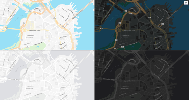
New work: #AmazonLocationServices has launched four new map styles as part of their Open Data Maps service. Collaborating w/ AWS to make these maps has been a pairing of some of our favorite things: working w/ #OpenStreetMap & delivering custom map styles! https://stamen.com/open-data-maps-for-amazon-location-service-are…
https://twitter.com/stamen/status/1635346715728551937
Read more here: https://stamen.com/open-data-maps-for-amazon-location-service-are-now-live/
#AWS #Amazon #AmazonLocationServices #OpenData #AmazonWebServices
Open Data Maps for Amazon Location Service are now live!
We are thrilled to share that Amazon Location Service has launched four new map styles as part of their Open Data Maps collection.Nicolette Hayes (Stamen)
https://www.openstreetmap.org/user/SK53/diary/401070
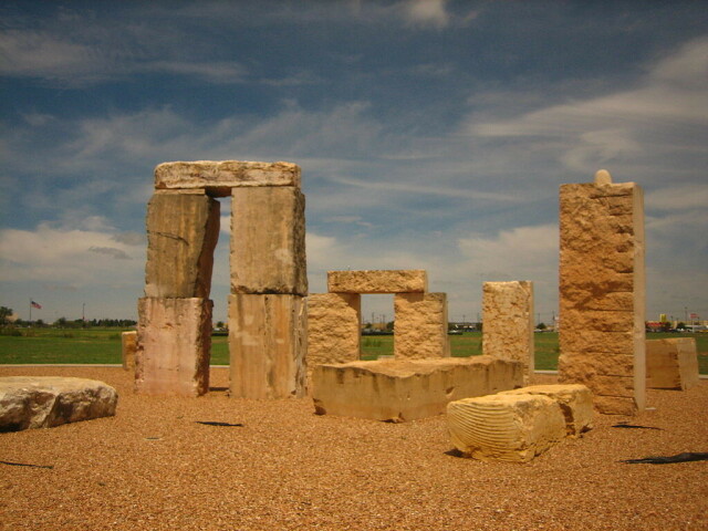
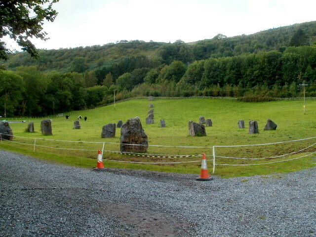
Mainly Gorsedd Stones, but including the Falcon Circle for USAF wiccans and a replica Stonehenge.
All images from Wikimedia Commons & CC-BY_SA or PD. Many more at: https://commons.wikimedia.org/wiki/Category:Modern_stone_circles
SK53's Diary | Seen on my (virtual) travels 2. Modern Stone Circles | OpenStreetMap
OpenStreetMap is a map of the world, created by people like you and free to use under an open license.OpenStreetMap
Vector files now sent to my friend, a graphic designer, who will build it into posters and a treasure map.
I love that #opensource code and resources allowed me to do this.
[1] https://www.qgis.org/ #qgis
[2] https://www.openstreetmap.org/ @openstreetmap
#rotary #canterbury #rotaryinternational #openstreetmap #kent
OpenStreetMap
OpenStreetMap is a map of the world, created by people like you and free to use under an open license.OpenStreetMap
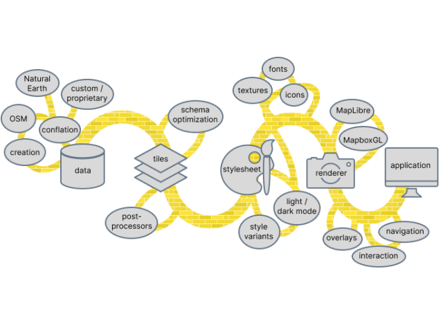
What is Full Stack Cartography?
In a series of presentations and podcasts over the past year, Stamen cartographers Alan McConchie and Stephanie May have been exploring the world of contemporary online map making, and how Stamen Design has developed a uniquely collaborative way of w…Alan McConchie (Stamen)

