Search
Items tagged with: qgis
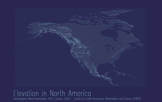
My first ever attempt to create an elevation joy plot 😁🗻
Tool: #QGIS
Data: USGS
#gischat

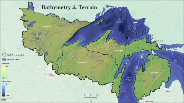
A map of the bathymetry and terrain of the greater Lake Superior region. Lake Superior is the world's largest freshwater lake by area. This is part of a large analysis to compute omnidirectional biodiversity connectivity. More on that later 😊 #QGIS
Used #qgis. Does anyone know an accurate way to mark intermediate measurements on a continuous legend in QGIS 3.34?

For the past 2 weeks or so we’ve had an ongoing earthquake swarm very close to the town of Grindavík in the Reykjanes Peninsula. The swarm is very likely caused by an inflating magma body currently at about 5 km depth. The shape of the body is most likely a flat sill expanding and causing earthquakes. These events might lead to an eruption very close to people’s homes and lots of infrastructure.
1/6

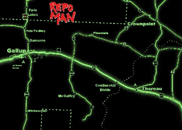
A slightly tweaked version of last years Repo Man (1984) map, but this time with the "Retro" #QGIS Easter egg deployed.
It is a recreation of the opening titles to one of my favorite movies and a place I used to live!
Reached the end of the line with your #GeoPandas plots? Replace them with maps rendered by QGIS.
http://anitagraser.com/2023/11/10/bringing-qgis-maps-into-jupyter-notebooks/
#maps #GISChat #DataScience #SpatialDataScience #DataViz #GIS

Bringing QGIS maps into Jupyter notebooks
Earlier this year, we explored how to use PyQGIS in Juypter notebooks to run QGIS Processing tools from a notebook and visualize the Processing results using GeoPandas plots. Today, we’ll go …Free and Open Source GIS Ramblings

Matt Travis: If you need help don’t be afraid to ask. - GeoHipster
Bio: UK based data wrangler and QGIS enthusiast who has somehow made a career out of working with open source software. Trying to build a better world through geo! Interviewed By Randal Hale Q.rjhale1971 (GeoHipster)

@northroadgeo
---
https://youtu.be/lvl8zVZ8glY?si=XKVrSmSdHv-CghEq
Cesium 3D Tiles in QGIS -- a quick overview
A quick highlights video showcasing some of the new capabilities introduced in QGIS 3.34 for viewing spatial data in the Cesium 3D tiles format.This work was...YouTube
Anyway, here's my bad map titled 'All the Scots in Scotland' which shows all places with 'scot' in their name. And yes, I have used Irn Bru colours, what's your problem? 😉
Data came from #OpenStreetMap Made in #QGIS and #inkscape
#Scotland #maps #irnbru
")