Search
Items tagged with: openstreetmap
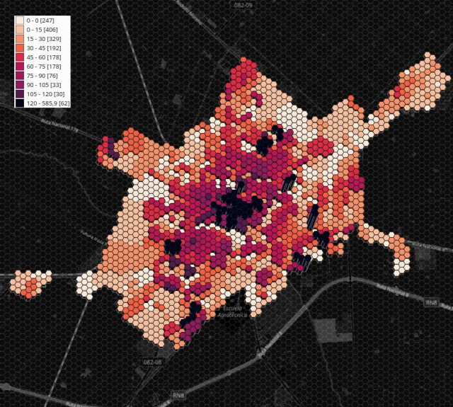
Día 9: Hexagons. 6 sides, 6 angles, and 6 vertices
Proyección cantidad de habitantes por hexágono (INDEC+IDE Pergamino) (r=200)
#OpenStreetMap #IDE #Pergamino
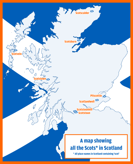
Anyway, here's my bad map titled 'All the Scots in Scotland' which shows all places with 'scot' in their name. And yes, I have used Irn Bru colours, what's your problem? 😉
Data came from #OpenStreetMap Made in #QGIS and #inkscape
#Scotland #maps #irnbru
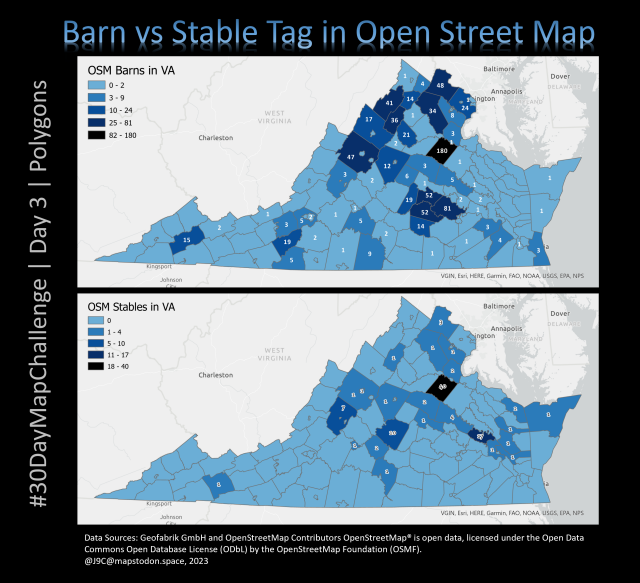
#30DayMapChallenge #OpenStreetMap #Virginia #chloropleth #barns #stables #HorsesOfMastodon #Horsetodon #horse #equestrian #DMV
Last day 2 map for #30DayMapChallenge (lines) is related to this day 1 point map https://en.osm.town/@SK53/111337236337206381.
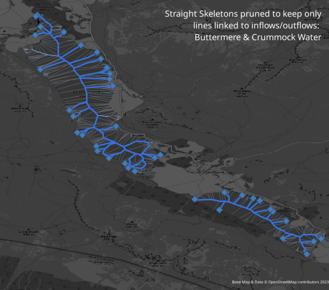
There has been a lot of interest within #OpenStreetMap about the best way to map hydrological networks and particularly if continuity should be kept through lakes.
The map shows progressive stages of pruning a straight skeleton of a couple of lakes retaining lines linked to outflows.
PS. I've played with these before sk53-osm.blogspot.com/2016/10/skeletons-in-water.html
It is a WIP but I *think* it is functional! Testing and feedback welcome.
This finally became possible b/c pgBouncer added support for prepared statements 🤓
#pgosm #postgis #openstreetmap #gischat
https://github.com/rustprooflabs/pgosm-flex/pull/243
https://www.graphhopper.com/blog/2023/10/18/graphhopper-routing-engine-8-0-released/
#OpenStreetMap #opensource #Java #gis #gischat #spatial #logistics #GraphHopper
GraphHopper Routing Engine 8.0 Released - GraphHopper Directions API
We have released version 8.0 of GraphHopper, the flexible and fast open source routing engine for OpenStreetMap. Read more about it on GitHub, try GraphHopper Maps and read on to find out what’s new.Peter (GraphHopper)
https://rcarto.github.io/posts/build_osrm_server/
OSRM is a routing software based on OpenStreetMap data. It can be used to find the fastest routes or compute time matrices.
This post describes how to set up this RAM-intensive software on a personal computer.
As a reward for a successful installation, I'm proposing a modest R package to create "All roads lead to ..." maps.
#rstats #rspatial #gischat #openstreetmap
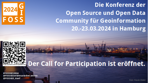
Der Call for Participation #FOSSGIS2024 ist eröffnet.
Es können Vorträge, Vorträge im Akademic Track, Demosessions, Lightning Talks, Workshops, Expert:innenfragestunden und
Anwendertreffen eingereicht werden.
Das Programmkomitee freut sich auf Einreichungen bis zum 06.11.2023: https://fossgis-konferenz.de/2024/callforpapers/
#FOSSGIS #OSGeo #OpenData #OSM #OpenStreetMap #Hamburg #TUHamburg #HCU
FOSSGIS 2024 - CfP
Die FOSSGIS-Konferenz ist im D-A-CH Raum die führende Konferenz für Freie und Open Source Software für Geoinformationssysteme OpenStreetMap.fossgis-konferenz.de

Les cartes sont-elles "objectives"?
Alors que des milliards de milliards de données sont créées sans cesse sur tout, l'ensemble du territoire n'est aujourd'hui pas entièrement cartographié. Que signifient la présence de blancs dans les cartes ? Quels en sont les enjeux de pouvoir ?France Culture
#PostGIS #Postgres #PostgreSQL #gischat
https://osm2pgsql.org/examples/raw-data-publication/
